A silver-grass photograph can make a mountain trip seem instantly attractive. It cannot tell you today’s conditions or the route you will walk. Using official information from the Korea Tourism Organization, Jeongseon and Ulsan, we compared Hwangmaesan, Mindungsan and Ganwoljae. This is desk research checked on October 4, 2026, not a hike report or a live flowering check. They are candidates for an autumn trip; this year’s peak appearance and same-day access require separate confirmation.
Hwangmaesan
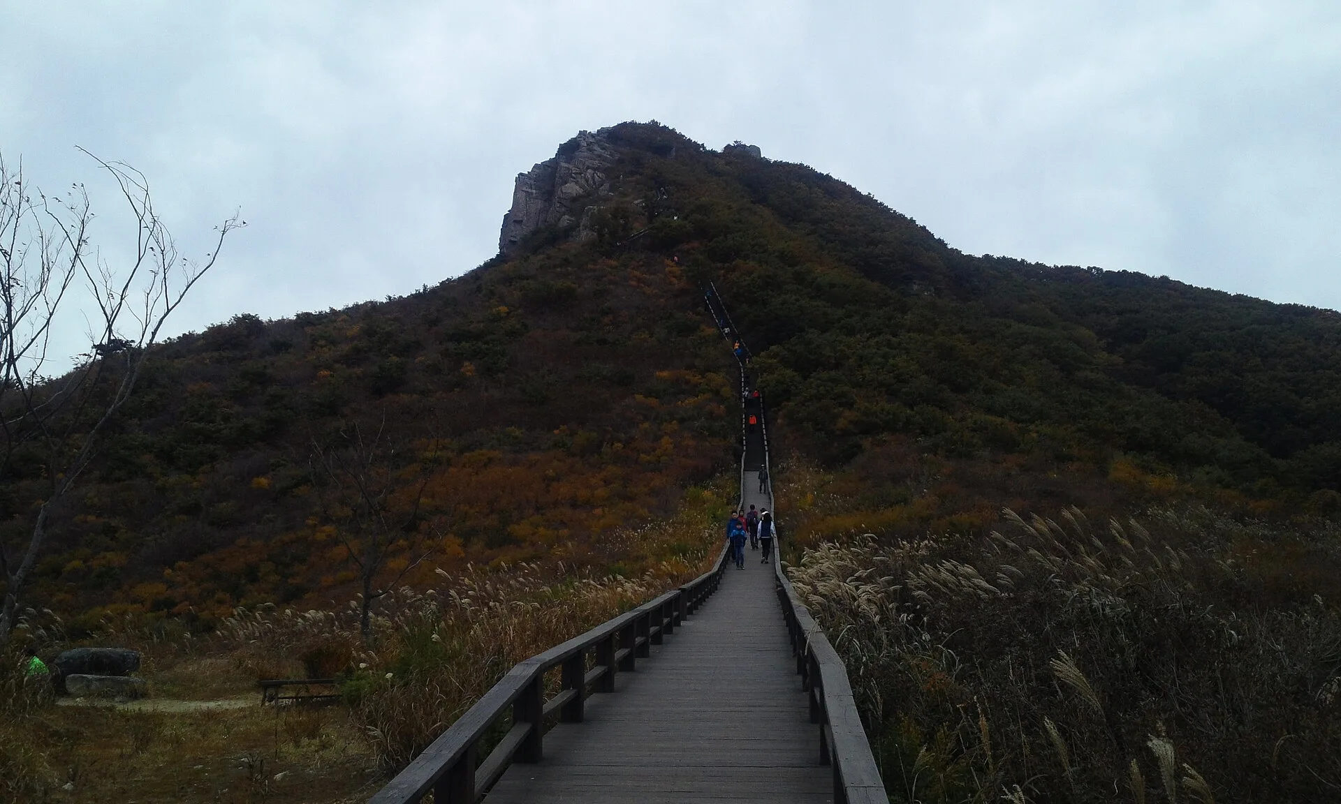
The Korea Tourism Organization introduces Hwangmaesan as a mountain with autumn silver grass. For a trip based around Hapcheon, I would investigate this candidate first. Our image is an older autumn reference photograph. It shows a mountain scene and steps, not proof that the grass or path is in the same condition today. Choose the actual starting point and section you want to walk before expecting a particular photograph’s colours and weather.
An accessible facility or section does not make an entire mountain uniform. Check the route from your arrival point to the place you want to see, including slopes and steps. If a companion’s mobility needs matter, seek information for that specific section. We have not classified every Hwangmaesan route as easy. Assigning a single difficulty to the mountain name would hide the differences between actual paths.
Mindungsan
Jeongseon’s guide identifies Mindungsan as a 1,119-metre mountain and introduces its upper silver-grass landscape. It describes routes with different lengths and gradients. I would consider it when a Jeongseon trip can be organised around time spent walking. Attractive vegetation and the work of reaching it are separate considerations. Include the descent and onward travel in the day, not just the ascent to the view.
The official tourism homepage carries a notice headed suspension of the Mindungsan connecting shuttle service. Do not assume transport mentioned in an old travel article remains available. Recheck the notice’s applicable dates and the transport you can actually use. We have not confirmed a replacement timetable. Published route examples cannot promise your own walking time in your weather and circumstances either.
Ganwoljae
Ulsan’s tourism information introduces silver grass at Ganwoljae in the Yeongnam Alps, the pass between Ganwolsan and Sinbulsan. Separating the pass from the neighbouring summit names helps define a trip. I would investigate it for an outing based around Ulsan or Ulju and focused on a mountain-pass landscape. Visiting the pass is not automatically a plan to climb every nearby summit. The starting point and connecting path matter.
A tourism landscape description does not prove that a particular road or trail is open today. Check current restrictions, your starting point and the way back. We have not promised a vehicle-access boundary or a universal arrival time. Before adding more peaks, decide whether your aim is the grass landscape or a longer hike. The time you can really walk is a better planning tool than the wish to collect another photograph.
Choose a region, then a section
These are not three stages of a connected local route. Start with which region is realistic from home: Hapcheon, Jeongseon or Ulsan–Ulju. Then connect a starting point, the section you want to see and the return route. This article does not claim a researched fastest journey to each place. Driving, public transport and staying overnight change the calculation, so verify it using your intended transport.
Leave room to rest and look around rather than filling the day with a guide’s example walking times. Ask about companions’ experience and preparation, and reduce the plan if the weather or access does not fit. The table avoids invented beginner scores and rankings of mountain danger. It offers questions for the specific path instead of presenting the fame of a mountain as a route assessment.
A peak-season photograph cannot be reserved
Choosing a date does not make the weather and vegetation cooperate. An old photograph and a general autumn description are not a live report. Recheck official notices and forecasts before departure; if a current landscape update is available, note when it was checked. A festival date does not establish identical conditions across every section. We have not guessed a definitive peak date for this year.
I would prioritise a route the group can actually use over the most dramatic image. Consider Hwangmaesan within a Hapcheon trip, Mindungsan for a walking-focused Jeongseon trip, and Ganwoljae for a pass landscape around Ulsan–Ulju. After that, the section’s information matters more than the destination’s reputation. Plan a day that can still be worthwhile without forcing the walk when the expected scene does not appear.
Our three picks
- HwangmaesanHwangmaesan
Investigate for a Hapcheon trip
- MindungsanMindungsan
Consider for walking time in Jeongseon
- GanwoljaeGanwoljae
Consider for a pass landscape around Ulsan–Ulju
Side by side
| Compare | Hwangmaesan | Mindungsan | Ganwoljae |
|---|---|---|---|
| Region | Hapcheon | Jeongseon | Ulsan–Ulju |
| Official focus | Autumn silver-grass mountain | Mountain with upper grass landscape | Yeongnam Alps pass landscape |
| First decision | Starting point and section | Which walking route | Starting point and connecting path |
| Transport checks | Specific facility access | Shuttle notice and actual service | Current access and restrictions |
| Companion checks | Slopes and steps on chosen section | Ascent, descent and time | Pass only or additional peaks |
| Potential drawback | Conditions differ by section | Old transport information may mislead | Separate pass visit from summit plans |
| Not confirmed | This year’s peak or today’s access | Today’s shuttle or personal duration | Vehicle access or today’s grass |
Our choice
For Hapcheon, start by investigating Hwangmaesan; for walking time in Jeongseon, Mindungsan; for a pass landscape around Ulsan–Ulju, Ganwoljae. Then choose the real section to walk. Recheck current access and seasonal conditions before travelling.
