A dramatic photograph is enough to make Bukhansan tempting. A summit name is not enough to plan the day. We compared three routes in Seoul Hiking Tourism Center’s official maps: Baegundae–Uigugok, Bukhansanseong–Daenammun and Samobawi–Bibong. This is desk research checked on October 5, 2026, not a field report or confirmation of current trail access. It does not treat technical climbing on Insubong as an ordinary hiking activity.
Baegundae–Uigugok
This is the candidate to examine when a clear summit objective appeals to you. The official map places the approach on the Ui-dong side. Begin by finding your actual starting point: a full mapped itinerary and a shorter approach near Doseonsa are different days. A walking-time figure detached from its endpoints can leave out a substantial part of the journey.
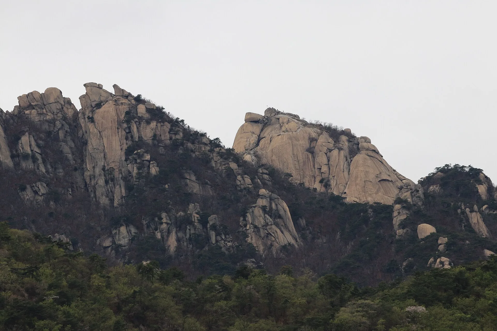
The drawback is the temptation to keep going because the summit is the goal. Official guidance mentions steep sections and installed handrails. Do not turn an attractive photograph into a recommendation for every first-time hiker. Conditions and your preparation matter. Our springtime photograph shows the rocky Baegundae area, not today’s surface, weather or access status.
Bukhansanseong–Daenammun
I would examine this plan for the fortress landmarks encountered along the way. The official hiking map connects the Bukhansanseong and Gugi sides. It gives you a different question from simply reaching a summit: which places do you want to notice during the walk? If you select different start and finish points, arrange the journey home before deciding where to park.
Fortress gates do not make a route a gentle stroll. Read the whole itinerary and its elevation profile instead of treating distance as a complete measure of effort. Add the approach, breaks and onward transport to your schedule. If time is tight, resist adding more gates just to make the completed list longer. A manageable plan is more useful than an ambitious checklist.
Samobawi–Bibong
The Gugi-side plan combines rock formations with landmarks such as Seunggasa and Geumseonsa shown on the official map. That makes it worth considering if those stops interest you more than a summit objective. Its appeal is the day you can assemble around them, not an invented claim that this is the best of Bukhansan.
The map distinguishes directions toward Bibong and Samobawi and explains backtracking. Nearby names on a map do not remove the need to navigate junctions. Follow designated paths and current signs. We are not giving instructions for climbing exposed rock or taking shortcuts outside the trail. Where a temple is part of the walk, remember that it is also a working religious space.
Match the map to your actual day
Two itineraries bearing the same summit name can have different approaches and descents. Do not transfer a full-route estimate to one short segment, or a short-segment estimate to the whole day. Mark the entry, exit and intermediate stops first. Extending the walk into a traverse changes the plan you originally compared.
Prepare route information before setting out, but do not assume a phone will always have signal or battery. Share the route and intended return with your companions and agree when to turn back. Crowds are not a safety guarantee. Nor does another person’s completed route demonstrate that your group has the same experience, equipment or time available.
Check access before leaving
A map with a 2025 filename explains routes; it is not today’s access notice. Check Bukhansan restrictions, entry hours and weather with Korea National Park Service before departure. Its detailed page was not reliably accessible during this research, so we do not claim the routes are currently open. Ask the park office if the status remains unclear.
Leave room to shorten the day after checking equipment, water, food and travel time. If rocky sections or limited experience are a concern, use official advice and local consultation to decide the appropriate scope. The table compares planning questions, not safety ratings, guaranteed walking times or a competitive ranking. Getting down within your prepared schedule matters more than collecting another destination.
Our three picks
- Baegundae–UigugokBaegundae–Uigugok
A clearly defined summit objective
- Bukhansanseong–DaenammunBukhansanseong–Daenammun
A day organized around fortress landmarks
- Samobawi–BibongSamobawi–Bibong
Rock formations and temple landmarks
Side by side
| Compare | Baegundae–Uigugok | Bukhansanseong–Daenammun | Samobawi–Bibong |
|---|---|---|---|
| Reason to choose | Summit objective | Fortress itinerary | Rocks and temples |
| Mapped approach | Ui-dong side | Bukhansanseong side | Gugi side |
| Planning priority | Whole route and descent | Transport from the finish | Junctions and backtracking |
| Avoid assuming | Short approach equals whole route | Gates mean an easy stroll | Nearby names mean an easy connection |
| Trade-off | Summit goal can encourage overreaching | Onward transport needs planning | Directions need attention |
| Check that day | Restrictions, hours, weather | Restrictions, hours, weather | Restrictions, hours, weather |
| Scope here | Map comparison; no field visit | Map comparison; access unconfirmed | Map comparison; no climbing instruction |
Our choice
Look first at Baegundae for a summit goal, Daenammun for a fortress-focused day, or Samobawi–Bibong for rocks and temples. Then put the name aside and confirm the actual start, descent and current restrictions. A good mountain day begins with a plan that fits your preparation, not the longest line you can draw on a map.
