A plan to see the sea in Busan needs a place in the day. A walk before a train departure and an afternoon kept free until sunset involve different constraints. We compared North Port waterfront park, Gwangalli and Dadaepo using public-agency and tourism material checked on October 3, 2026. This is research, not a report of walks or an official ranking. The useful question is where a particular outing fits your itinerary.
North Port waterfront park
North Port is the first candidate I would examine for a waterfront break attached to plans around Busan Station. A government report documents pedestrian-deck connections between the station, waterfront park and international passenger terminal. That link is a concrete reason to investigate the route. It does not mean every part of the park is equally close to your train platform.
Choose an entrance and a return path before planning a complete circuit. Decide whether luggage will accompany you. We have not timed a walk from the station to a particular park location, so no precise connection time is promised here. Use current maps, signs and operating notices, and leave room to return for the train. A comfortable stop on a designated path is the aim of this recommendation.
Gwangalli
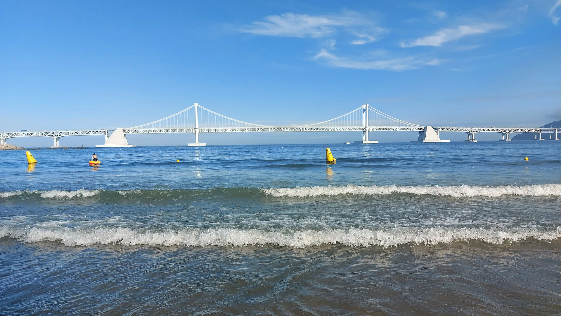
Gwangalli is my starting candidate for a beach walk with views of Gwangan Bridge and a city itinerary afterwards. Busan’s tourism material presents the waterfront alongside the bridge and surrounding urban area. If you want a meal or café stop near the outing, mark a few possible locations on a map and choose the stretch of beach around them. The article’s photograph represents this beach and bridge.
The trade-off is itinerary creep. Adding shops and stops at both ends can turn time near the water into a series of appointments. Start with one waterfront stretch and one place to rest. For evening lighting or a special event, consult current notices for your date. A daytime reference photograph cannot establish that the particular evening scene or programme you want will be available.
Dadaepo
Dadaepo deserves consideration when the afternoon itself can revolve around the beach and sunset. Korea Tourism Organization material highlights its sunset scenery. Waiting until evening creates a different visit from stopping for a quick picture. Our reason for including it is the opportunity to allocate unhurried time to one waterfront destination, rather than promising a spectacular sky on every date.
Check the return journey alongside the arrival. Your accommodation and next appointment determine the transport burden. Two places sharing a beach symbol on the map are not automatically easy to combine in a short outing. Weather and current access notices also matter. Do not assume sand, water’s edge and designated paths offer identical walking conditions, particularly when planning for a stroller or wheelchair.
Put the journey next to the photograph
Write the starting point and final destination beside each candidate. A station, hotel or restaurant changes what is practical. Having a public waterfront space on the map is different from reaching the section you actually want. Check the current pedestrian and transport connections after using the tourism descriptions to choose a general area.
With limited time, one location is enough. North Port is a route to investigate around a station itinerary; Gwangalli may suit a beach-and-meal plan; Dadaepo may suit an afternoon kept free. These are editorial planning suggestions, not official journey durations. We do not claim any location is always quieter or easier to reach. The actual date and transport situation still need checking.
Keep the walk within the visitor space
This recommendation is about designated public walking areas. A location appearing in news does not justify seeking wildlife, crossing barriers or descending to the water for a photograph. Busan’s safety material for North Port is relevant reading alongside on-site instructions. We have not made an animal sighting part of the attraction or promised a particular news-related scene.
For luggage, wheelchairs or strollers, check the pavement, slopes and access route of the section you intend to use. A beach name alone cannot answer those questions. Keep an indoor alternative for poor weather and confirm transport before leaving. The table focuses on itinerary choices and checks, rather than assigning scenic scores to places we have not personally assessed.
Our three picks
- North Port parkNorth Port park
Investigate a selected waterfront section around Busan Station
- GwangalliGwangalli
Combine beach and bridge views with an urban itinerary
- DadaepoDadaepo
Keep an afternoon for the beach and sunset
Side by side
| Compare | North Port park | Gwangalli | Dadaepo |
|---|---|---|---|
| Itinerary starting point | Busan Station plans | Beach and city plans | An afternoon by the sea |
| Scenery focus | Port-side public space | Sea and Gwangan Bridge | Beach and sunset |
| Map check | Deck, entrance and return | Beach section and next stop | Access and transport home |
| Leave time for | Returning to the train | A rest after the walk | Sunset and the return journey |
| Trade-off | Need to limit the park route | Easy to add too many stops | Travel burden depends on origin |
| Current checks | Safety and route operation | Lighting, events and access | Weather, sunset and access |
| Article photograph | A different location | Gwangalli reference image | A different location |
Our choice
If the train determines the day, investigate North Port’s exact route first. For a beach-and-meal outing, start with Gwangalli. For an afternoon you can leave open, consider Dadaepo and check the journey home. I would choose one waterfront and keep time to sit there, rather than collect three beach names in a rushed day.
