An old walking account can be a poor transport plan if the trail’s endpoint has changed. We checked Jeju Olle’s official route screens on October 3, 2026, for Routes 6, 7 and 10. This comparison uses the operator’s current distances, estimated times and difficulty ratings. It is desk research, not a report of completing the walks or an objective scenery ranking. Choose one route, then verify notices for the day you intend to go.
Route 6
The current route runs from Soesokkak Bridge to the Jeju Olle Tourist Center. The operator lists 10.1 kilometres, three to four hours and one star out of three for difficulty. Its connection with Seogwipo and Lee Jung-seop Street is a reason to investigate it when you want some city time alongside walking. It is the shortest of the three distances checked for this comparison.
Shorter does not mean effortless for every walker. Add travel to the start and onward transport from the finish. Meals and photography need their own time allowance. A route connected with a city does not have one uniform surface or access condition throughout. For a first visit, I would begin with the walk and one meal rather than adding a long sequence of extra appointments.
Route 7
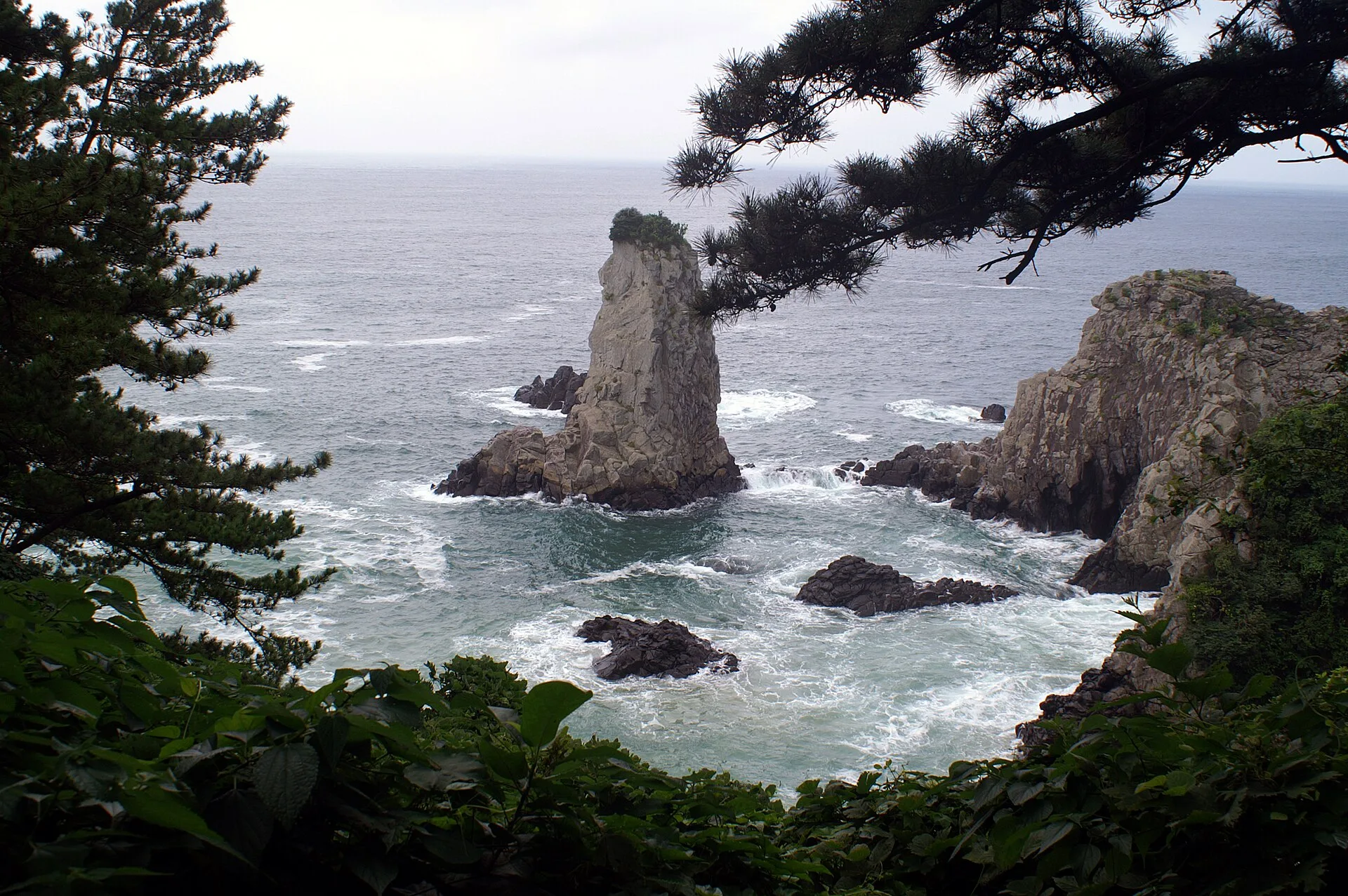
The official screen currently runs Route 7 from the Jeju Olle Tourist Center to Seogwipo Bus Terminal. It lists 12.9 kilometres, three to four hours and two stars for difficulty. Oedolgae, Subong-ro and Beophwan Port are points to investigate along this coastal candidate. The photograph shows Oedolgae; it does not represent every part of the other routes.
Older accounts describing a 17.6-kilometre walk finishing at Wolpyeong should not be treated as the current route instructions. On our check date, the operator lists the bus terminal and 12.9 kilometres. We have not inferred a date for the change. Compare the endpoint of any saved map with the official route and read change or detour notices. The difference matters for the journey after the walk as well as the distance walked.
Route 10
Route 10 is the Hwasun–Moseulpo walk, beginning at Hwasun Golden Sand Beach and ending in Hamo, Daejeong-eup. The official guidance is 15.6 kilometres, five to six hours and two difficulty stars. Views toward Sanbangsan and the coastal area including Songaksan give you specific places to investigate. It is the longest distance and time allowance of the three checked candidates.
I would consider it when the day can revolve around walking. Leave space before the next reservation, because an estimated time does not promise your arrival. The start and finish differ, so decide how to retrieve a car or use onward public transport. Check weather, access restrictions and detours. A reference photograph cannot establish the coast’s conditions on your walking day.
Count time outside the trail
Put transport to the start, breaks, meals and the return journey beside the operator’s walking estimate. A three-to-four-hour route is not automatically a complete four-hour outing. Knowing how to leave the endpoint makes the plan more concrete. We have not timed these walks or assessed individual fitness; the published numbers remain operator guidance.
Drivers should check parking and vehicle retrieval arrangements. Public-transport users should look up actual services for their date. We have not supplied unverified bus numbers or last-departure times. Work out the return before setting the start time. I would also leave a second full route for another day on a first visit, keeping the aim a comfortable outing rather than a completion count.
Reopen the map before leaving
Current route information and change notices deserve attention before departure. A saved track is not evidence that the same path applies today. Route 7’s endpoint is a clear reason to make that check. Bring water, appropriate supplies and weather-suitable equipment, and plan to finish in daylight. Leave yourself the option to change the itinerary if conditions or restrictions make walking unsuitable.
Difficulty stars are the operator’s general guidance, not a guarantee for every person. For wheelchairs or strollers, check designated sections instead of assuming whole-route access. A limited accessible section described on Route 6 does not establish that the entire walk has the same conditions. Use the table to narrow the choice, then verify the operator’s information again for the actual visit.
Our three picks
- Route 6Route 6
Investigate a shorter walk connected with Seogwipo
- Route 7Route 7
Check the current endpoint for a coastal walk via Oedolgae
- Route 10Route 10
Allocate a longer walking day to Hwasun–Moseulpo
Side by side
| Compare | Route 6 | Route 7 | Route 10 |
|---|---|---|---|
| Official distance | 10.1km | 12.9km | 15.6km |
| Official estimated time | 3–4 hours | 3–4 hours | 5–6 hours |
| Official difficulty | ★☆☆ | ★★☆ | ★★☆ |
| Start | Soesokkak Bridge | Jeju Olle Tourist Center | Hwasun Golden Sand Beach |
| Finish | Jeju Olle Tourist Center | Seogwipo Bus Terminal | Hamo, Daejeong-eup |
| Points of interest | Seogwipo, Lee Jung-seop Street | Oedolgae, Subong-ro, Beophwan | Sanbangsan views, Songaksan |
| Special check | Section access versus whole route | Older Wolpyeong/17.6km descriptions | Longer day and onward transport |
Our choice
I would investigate Route 6 first for a shorter walk with city time, Route 7 for its coastal points after checking the current map, or Route 10 for a day reserved for the Hwasun–Moseulpo coast. For all three, settle the return journey before leaving. The current official map is a better departure companion than an attractive photograph in an old itinerary.
