The Seoul metropolitan railway appeared in Korea’s trending searches. We compared Kakao Subway, Subway Korea and Seoul Metro’s official metropolitan map using developer and public-agency material checked on October 7, 2026. This is desk research, not a timed journey test. The map is a network-reading alternative rather than a promise of the same live routing functions as an app. Unlike our comparison of the systems in Seoul, Beijing and Tokyo, this article chooses information tools for a Seoul-area trip.
Kakao Subway
The developer describes a map based on station locations, time-based routing and carriage-door information for stairs toward ticket gates. I would start here when the route from the train to the exit is part of my question. Knowing where to alight may be useful at a large interchange. It does not establish an accessible, step-free route; check the facilities you actually need separately.
The limitation is the difference between a planned time and a completed journey. The description says routing uses timetables from railway operators. Read the direction, transfer and exit alongside the time. We did not test current accuracy across all lines. If you want an everyday tool, begin with one regular journey and check whether the information you need is available.
Subway Korea
Malang Studio describes intermediate-stop routing, favorites and exit, timetable and transfer information. It also describes support for languages beyond Korean, making it worth investigating for an English-reading visitor. I would first examine the intermediate-stop function when planning to meet someone or pause at another station before continuing.
The developer’s FAQ explains that operators update real-time information at different intervals, so animated train locations can appear to jump. Do not interpret an animation as a continuous observation of every train. The listing includes in-app purchases despite the free download; read payment conditions separately. Store ratings are not evidence of which app gives the most accurate route. Check your device, language and actual journey instead.
Seoul Metro’s official map
Seoul’s Open Data Plaza lists Seoul Metro’s metropolitan subway map in four languages and refers users to Cyber Station. I would use this to understand where a route goes within the larger network. Follow a line and identify where it connects with another. That is a different question from calculating a journey time in an app.
Cyber Station’s detailed screen did not load in our automated check, so we did not verify its current controls, fares or live operation features. Our evidence is the public agency’s map listing. Read update information and scope before relying on a saved file. Confirm new sections and changed services with the current operator guidance. An official file stored earlier does not update itself.
Compare one real journey
When trying the two apps, enter the same origin, destination and planned time. Match the preference for fewer changes or a shorter trip before comparing suggestions. Add an intermediate stop if that is part of the plan. This is a proposed check, not a route test we have already performed. No measured winner for time, transfer count or fare is claimed.
Arrival at a station is not necessarily arrival at your appointment. Connect the final exit with the walk to the destination. If you need a lift, verify station facilities instead of assuming that a suggested carriage door provides step-free access. Read the destination on the train, including branch and express-service distinctions. For a last-train plan, give current operator and station guidance priority over an old saved itinerary.
Choose a default, keep a reference
You do not need to switch among all three constantly. Try Kakao Subway if alighting and exit-oriented information is the attraction, or Subway Korea if an intermediate stop and language support are important. Keep the official map as a reference for network connections. Leave room in an essential appointment for your own walking and waiting.
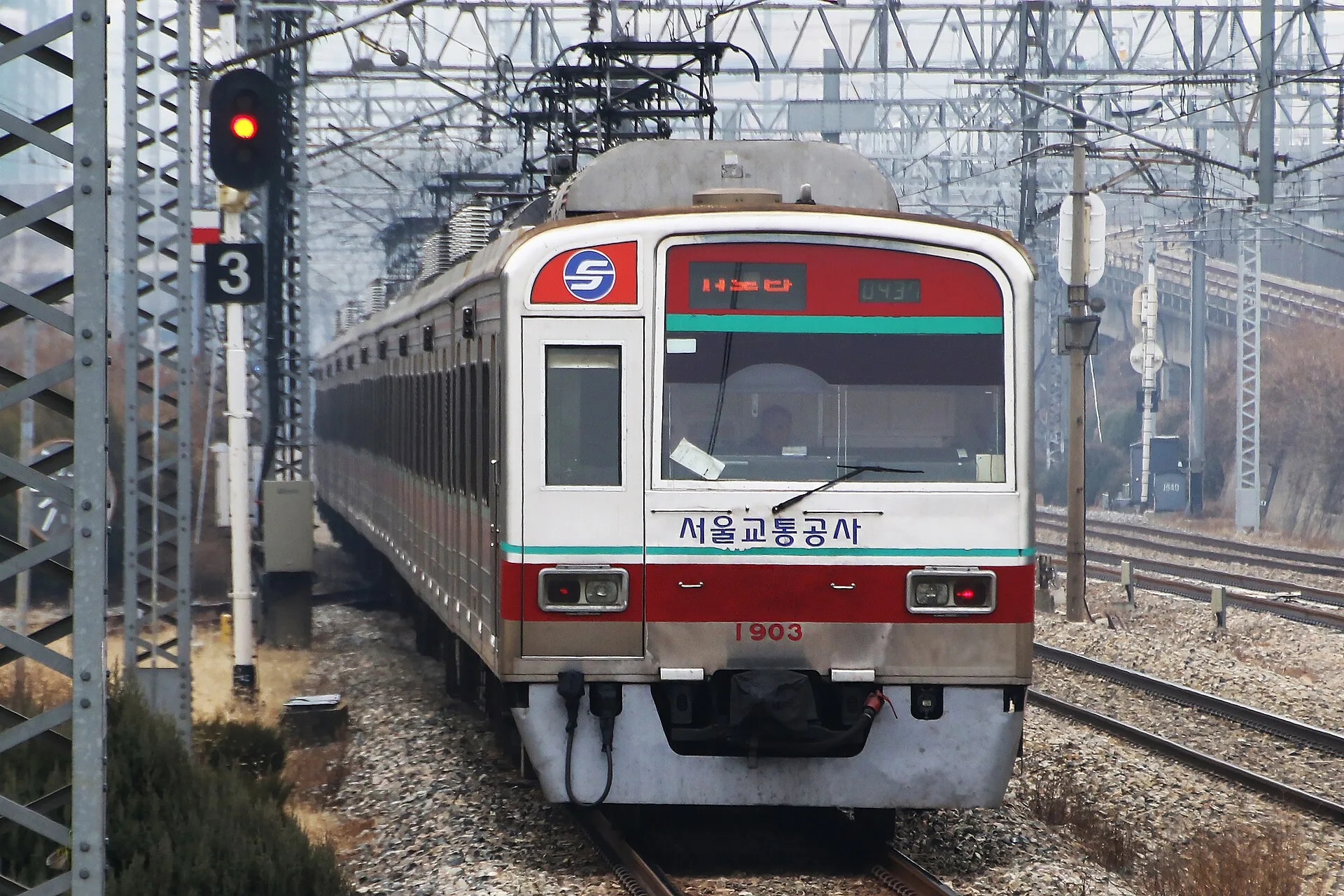
The photograph is a historical reference of a Line 1 train leaving Geumjeong. It shows neither current operation nor any application screen. The table separates developer-described features from the checks still needed on your device. Define today’s destination, understand the direction and transfer, and follow the final exit. That is a more useful travel goal than finding an app with a universal fastest label.
Our three picks
- Kakao SubwayKakao Subway
Explore alighting and exit information
- Subway KoreaSubway Korea
Check stops and language support
- Seoul Metro official mapSeoul Metro official map
Read the network connections
Side by side
| Compare | Kakao Subway | Subway Korea | Seoul Metro official map |
|---|---|---|---|
| Type | Routing app | Routing app | Official map resource |
| Description checked | Carriage doors and timetable-based routes | Intermediate stops, favorites, transfers | Metropolitan map in four languages |
| First question | Where should I alight for the exit? | Can I include a stop along the way? | Where do lines connect? |
| First check | One regular journey | One journey with an intermediate stop | Stations, lines and update date |
| Live-data interpretation | Accuracy across all routes not tested | FAQ explains differing update intervals | Do not assume a live service |
| Trade-off | Timetable versus actual journey | Check paid items and language scope | Detailed screen access not verified |
| Check separately | Facilities and current operation | Facilities and current operation | Current services and new sections |
Our choice
I would try Kakao Subway for an exit-oriented question or Subway Korea for an intermediate stop and language support. Keep the official map for understanding the wider network. Choose the information that helps you understand today’s train direction, transfer and final exit.
